Niyanig ng .6.6 magnitude na lindol ang Caingan, Masbate kaninang alas-8:03 ng umaga. Naramdaman ito sa ilang bahagi ng Luzon at Visayas.
Kasabay ng malakas na pagyanig ng lindol sa Masbate ang paglalabas ng bulletin ng Philippine Institute of Volcanology and Seismology (PHIVOLCS-DOST) dahil sa abnormal na kundisyon ng apat na aktibong bulkan—ang Taal sa Batangas, Mayon sa Albay, Kanlaon sa Negros Occidental, at Bulusan sa Sorsogon.
Ibig sabihin, nasa Alert Level 1 ang mga bulkan na ito.
Mahigpit na paalaala ng PHIVOLCS, mag-ingat ang publiko at huwag pumasok sa 6-kilometer radius Permanent Danger Zone para makaiwas sa sakuna na maaaring idulot ng mga landslide, pagbagsak ng mga bato, abo at phreatic eruptions mula sa mga nabanggit na bulkan.
Narito ang mga bulletin ng PHILVOLCS:
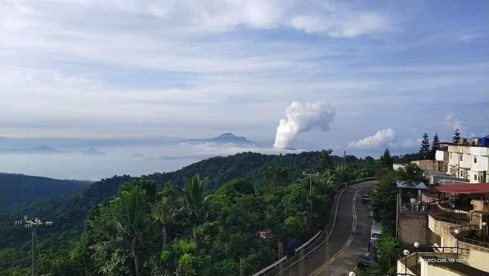
TAAL VOLCANO
In the past 24-hour period, the Taal Volcano Network recorded five (5) volcanic earthquakes. Weak steaming or fumarolic activity rising 20 meters high before drifting south-southwest was observed from vents on the Main Crater. Alert Level 1 (Abnormal) is maintained over Taal Volcano. DOST-PHIVOLCS reminds the public that at Alert Level 1, sudden steam-driven or phreatic explosions, volcanic earthquakes, minor ashfall, and lethal accumulations or expulsions of volcanic gas can occur and threaten areas within the Taal Volcano Island (TVI). DOST-PHIVOLCS strongly recommends that entry into TVI, Taal’s Permanent Danger Zone or PDZ, especially the vicinities of the Main Crater and the DaangKastila fissure, must remain strictly prohibited. Local government units are advised to continuously assess previously evacuated barangays around Taal Lake for damages and road accessibilities and to strengthen preparedness, contingency, and communication measures in case of renewed unrest. People are also advised to observe precautions due to ground displacement across fissures, possible ashfall, and minor earthquakes. Civil aviation authorities must advise pilots to avoid flying close to the volcano as airborne ash and ballistic fragments from sudden explosions and wind-remobilized ash may pose hazards to aircraft.
MAYON VOLCANO
Mayon Volcano’s monitoring network recorded one (1) rockfall event during the 24- hour observation period. Moderate emission of white steam-laden plumes that rose 750 meters before drifting northeast, southwest, and west-southwest was observed. Sulfur dioxide (SO2) emission was last measured at an average of 222 tonnes/day on 23 July 2020. Ground deformation data from Precise Leveling surveys on 12–19 June 2020 indicated slight inflation of the edifice relative to the February 2020 survey. Electronic tilt data also indicated non-steady inflation of the middle to upper edifice that began in late 2019. This follows an inflationary trend that has been recorded by continuous GPS monitoring since the middle of 2019. DOST-PHIVOLCS would like to remind the public that Mayon Volcano is at Alert Level 1, which means that it is at an abnormal condition. Although this means that presently no magmatic eruption is imminent, it is strongly advised that the public refrain from entering the 6-kilometer radius Permanent Danger Zone (PDZ) due to the perennial life-threatening dangers of rockfalls, landslides/avalanches at the middle to upper slope, sudden ash puffs and steam-driven or phreatic eruptions from the summit. Active stream/river channels and those identified as perennially laharprone areas on all sectors of the volcano should also be avoided especially during extreme weather conditions when there is heavy and prolonged rainfall.
KANLAON VOLCANO
Kanlaon Volcano’s monitoring network recorded four (4) volcanic earthquakes during the 24-hour observation period. Moderate emission of white steam-laden plumes that rose 500 meters before drifting northwest and northeast was observed. Sulfur dioxide (SO2) emission was measured at an average of 1012 tonnes/day on 02 August 2020. Ground deformation data from continuous GPS measurements indicate slight inflation of the lower and mid slopes since May 2020, while short-term electronic tilt monitoring on the southeastern flanks recorded inflation on the lower to mid slopes that began on June 21, 2020. These parameters may indicate hydrothermal or magmatic processes occurring beneath the edifice. DOST-PHIVOLCS would like to remind the public that Kanlaon Volcano is at Alert Level 1, which means that it is at an abnormal condition and has entered a period of unrest. The local government units and the public are strongly reminded that entry into the 4-kilometer radius Permanent Danger Zone (PDZ) must be strictly prohibited due to the further possibilities of sudden and hazardous steam-driven or phreatic eruptions. Civil aviation authorities must also advise pilots to avoid flying close to the volcano’s summit as ejecta from any sudden phreatic eruption can be hazardous to aircraft.
BULUSAN VOLCANO
Bulusan Volcano’s monitoring network did not detect any volcanic earthquake during the 24-hour observation period. Weak emission of white steam-laden plumes from the lower southeast vent was observed. Ground deformation data from continuous GPS measurements indicate slight inflation on the edifice since July 2020, while the long-term trend since May 2019 denotes that the edifice is still deflated. These parameters indicate that volcanic processes are underway beneath the edifice that may be caused by deep-seated degassing or hydrothermal activity or magmatic intrusion. Alert Level 1 (abnormal) status prevails over Bulusan Volcano, which means that it is currently in an abnormal condition. Local government units and the public are reminded that entry into the four-kilometer radius Permanent Danger Zone (PDZ) is strictly prohibited and that vigilance within the two-kilometer Extended Danger Zone (EDZ) on the southeastern sector must be exercised due to the increased possibilities of sudden and hazardous phreatic eruptions. Civil aviation authorities must also advise pilots to avoid flying close to the volcano’s summit as ash from any sudden phreatic eruption can be hazardous to aircraft. Furthermore, people living within valleys and along river/stream channels especially on the southeast, southwest and northwest sector of the edifice should be vigilant against sedimentladen stream flows and lahars in the event of heavy and prolonged rainfall.